For this lab activity we headed out to a prairie area south of South Middle School for some lessons on Ground Control Points (GCPs). GCPs are basically a ground control that your UAS can pick up to help with the accuracy of your data. What we did to practice using GCPs and to learn more about them was setting up several points and then using various Global Positioning Systems (GPSs) so we could test the accuracy of each of the devices.
Study Area:
Our area of interest was two small drainage ponds south of South Middle School (Figure 1). The South Middle School community garden was just to the North of our study area and we set up home base at the Northwest corner (Figure 2). We conducted this small study on September 30th from 4-7pm.
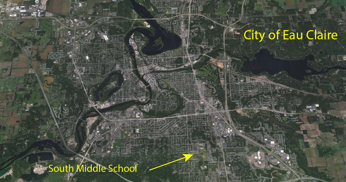 |
| Figure 1: South Middle School is located south of Highway 12 and west of Highway 93 |
 |
| Figure 2: Map showing where our home base and study area were in relation to South Middle School |
The first step that we took was getting all the GCPs ready. Our GCPs consisted of a 4x4 black and white material that we could easily lay down over an area and stake it. Before we set up our 6 GCPs we first had to logically think about where we should put them. In order for your GCPs to be useful at all, you need to have at least three so that the computer can triangulate their position. There was a trail that went around one pond so that made for a nice flat area to lay our GCPs out. We set 5 of the GCPs outside the perimeter of our study area as well as one that was a little more inside the perimeter. The reason why you want some inside your study area is to lessen distortion of the accuracy of the GCPs. If you only have them around the perimeter then the center of your study area may be distorted.
Once all the GCPs were set up we used five different GPSs and tested each of their accuracies, The five we used were as follows and their approximate price listed beside them.
Dual Frequency Survey Grade GPS-$18k
Bad Elf GNSS Surveyor GPS-$600
Bad Elf GPS-$125
Garmin GPS-Less than $100
A smart phone- Free if ya have one!
As with many things in the geospatial industry, it is up to us to decide what kind of accuracy we are going to need. That is where this activity is useful because it can help us decide if we want and/or need to spend 18 grand on a survey grade GPS that has centimeter accuracy or if we need something that we can get at an everyday Gander Mountain. Yes with the Dual Frequency we will achieve the absolute best, but depending on our work environment it may not be plausible to carry that big heavy thing into the bush and quite frankly, most of us do not have 18k to be able to afford that system. Nonetheless we moved forward and took points with each system so we could compare them later (Figure 3). One point of interest about GCPs in the use of mobile devices in collecting GCPs. This is a bad idea and many people continue to use this method. Mobile devices are excellent for taking you somewhere on a map or texting someone but not for collecting GPS points as a GCP. There is too much interference with these machines and they cannot be trusted, they will harm your data and make it inaccurate. The Dual Frequency on the other hand is very accurate, so much so that it needs to be leveled as shown in Figure 4.
 |
| Figure 3: Myself using the Dual Frequency Survey grade GPS to take a point of the 6th GCP |
 |
| Figure 4: Level on the Dual Frequency GPS |
Once we had points from every single GPS, we came back to home base where we set up for a multicopter flight. This flight was made possible by group 1 (preflight checks and planning) and brought to you by Mission Planner (Mission planning software)(Figure 5). Professor Joe Hupy was the Pilot in Command and we watched the Matrix make its grid pattern over the pond (Figure 6). Michael Bomber safely landed the Matrix as the whole class watched (Figure 7).
 |
| Figure 5: Mission Planning software showing the statistics of the mission we flew and the flight path |
 |
| Figure 6: Professor Pierson, Michael Bomber, and Professor Hupy taking their eyes off the Matrix. NEVER DO THIS!! |
 |
| Figure 7: Michael Bomber ensuring that the Matrix lands safely |
This exercise was able to show us the basics of GCPs and how they are implanted in the real world. As far as discussing which GPS was the best for this exercise, I would pick the Dual Frequency. I would like to note that if we did not already have one in stock at the university then I would not have picked this GPS but since we did and since the terrain was stable and easy to walk around, it was not cumbersome to use that big heaping GPS to collect those points. Was it overkill in terms of accuracy? Maybe, but you can never go wrong with better accuracy if all it involved was just a little more work. Now if I had to pick a backup favorite I would have picked the Garmin GPS since as shown in Figure 8 below, it had the next best accuracy and it was not cumbersome at all. The Garmin is a hand held device that was just as easy to use as the Bad Elfs, but during this test, the Garmin came out on top for the handheld devices. I don't not know why but the Bad Elfs underperformed in my opinion and I do not see much of a difference between the survey Bad Elf and the regular Bad Elf. I am also puzzled as to the accuracy of most of the GPSs in general, it seems as though most of these do not even have meter accuracy!
 |
| Figure 8: Map showing the location of all the GPS points during out GCP test. |
No comments:
Post a Comment